


Center 2 Voting District, Clark County, Kansas
About
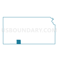
Outline

Summary
| Unique Area Identifier | 584232 |
| Name | Center 2 Voting District |
| County | Clark County |
| State | Kansas |
| Area (square miles) | 201.64 |
| Land Area (square miles) | 201.01 |
| Water Area (square miles) | 0.63 |
| % of Land Area | 99.69 |
| % of Water Area | 0.31 |
| Latitude of the Internal Point | 37.14503750 |
| Longtitude of the Internal Point | -99.82606130 |
Maps


Graphs
Select a template below for downloading or customizing gragh for Center 2 Voting District, Clark County, Kansas


Neighbors
Neighoring Voting District (by Name) Neighboring Voting District on the Map
- Voting District 101, Harper County, OK
- Voting District 301, Harper County, OK
- Appleton Township Voting District, Clark County, KS
- Center 1 Voting District, Clark County, KS
- Englewood Township Voting District, Clark County, KS
- Lexington Township Voting District, Clark County, KS
- Sitka Township Voting District, Clark County, KS
Top 10 Neighboring County Subdivision (by Population) Neighboring County Subdivision on the Map
- Laverne CCD, Harper County, OK (1,967)
- Buffalo CCD, Harper County, OK (1,718)
- Center township, Clark County, KS (974)
- Appleton township, Clark County, KS (940)
- Englewood township, Clark County, KS (125)
- Lexington township, Clark County, KS (78)
- Sitka township, Clark County, KS (63)
Top 10 Neighboring Place (by Population) Neighboring Place on the Map
Top 10 Neighboring Unified School District (by Population) Neighboring Unified School District on the Map
- Laverne Public Schools, OK (2,407)
- Buffalo Public Schools, OK (1,694)
- Ashland Unified School District 220, KS (1,229)
- Minneola Unified School District 219, KS (1,085)
Top 10 Neighboring State Legislative District Lower Chamber (by Population) Neighboring State Legislative District Lower Chamber on the Map
Top 10 Neighboring State Legislative District Upper Chamber (by Population) Neighboring State Legislative District Upper Chamber on the Map
- State Senate District 27, OK (72,228)
- State Senate District 38, KS (70,617)
- State Senate District 33, KS (64,554)
Top 10 Neighboring 111th Congressional District (by Population) Neighboring 111th Congressional District on the Map
Top 10 Neighboring Census Tract (by Population) Neighboring Census Tract on the Map
- Census Tract 9671, Clark County, KS (2,215)
- Census Tract 9522, Harper County, OK (1,967)
- Census Tract 9521, Harper County, OK (1,718)